Much of the recent atmospheric river precipitation in Washington has fallen as warm rain rather than snow, producing extreme runoff and historic flooding in the short term but doing relatively little to rebuild the mountain snowpack that is crucial for long‑term drought relief.

River rainfall totals
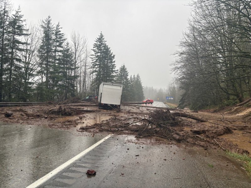
Storm‑total rainfall from this multi‑day atmospheric river has reached double‑digit amounts in the high terrain, with forecasts and observations showing more than 10 inches over parts of the Washington Cascades and Olympics. Lowland areas from the Puget Sound region into southwest Washington have seen roughly 3–7 inches of rain over the event, with localized higher totals near the foothills where orographic effects enhance rainfall.


Additional waves have added 1–4 inches more across the lowlands and 4–10 inches over the mountains, driving storm totals in some river basins into the 12–16 inch range and pushing many rivers into major or near‑record flood.

This is why gauges on rivers such as the Skagit, Snohomish, Snoqualmie, and Puyallup have surged so quickly, with runoff responding almost immediately to the warm, high‑intensity rainfall.

Why this does not fix drought
Despite the huge rainfall totals, Washington entered this event with a significant hydrologic deficit and a notably poor early‑season snowpack after a warm, dry October and November. Recent snow‑drought assessments and USDA figures show Washington’s snow water equivalent running well below normal, with some estimates near 40–70% of median in key basins such as the Cascades and Puget Sound watershed.

Because snow levels during the atmospheric river were relatively high, much of the precipitation that might normally fall as accumulating snow instead fell as rain, immediately running off into rivers and rapidly passing through the system. This boosts short‑term streamflow and causes flooding but does little to build the deep mountain snowpack that acts as a natural reservoir and slowly feeds rivers and water supplies through spring and summer, which is what ultimately determines longer‑term drought relief.

The importance of snowpack for long‑term water supply
Washington’s drought problems in recent years have been driven largely by snowpack shortfalls and early melt, not just by a lack of individual heavy rain events. Even when one winter or spring brings near‑normal precipitation, warm storms and rain‑on‑snow events can strip snow off the mountains early, leading to below‑normal summer streamflows, higher wildfire risk, and water‑supply stress despite impressive seasonal rainfall totals.
For meaningful, sustained drought improvement, Washington needs a series of colder storms that deposit and maintain a healthy snowpack at mid and high elevations, building up snow water equivalent through late winter. Until that happens, bursts of warm, flood‑producing rain like this atmospheric river mainly trade one hazard (drought and low reservoirs) for another (short‑term catastrophic flooding) without fully solving the underlying long‑term water‑supply problem.